Good news, bad news

GOOD NEWS!
As of 0600 this morning (it’s Friday today, for those wondering), the Theewaterskloof dam has 5,476,628,400,000 more litres of water in it than its low point on Tuesday at 1200.

BAD NEWS!
That only equates to its volume being 1.14% up on earlier in the week.
Current level = 14.05%*.


And therein lies the message that there’s a long, LONG way to go yet till we’re out of this mess, folks. Keep saving water!

* Obviously, there will still be inflows that haven’t reached the dam yet, so this figure will rise a bit.

What is Sea Foam?

And so, the GREAT STORM OF JUNE 2017© has passed over Cape Town. Schools were damaged, trees were toppled, roads were flooded, homes were lost, people were killed. Anyone lamenting the decision to close the schools here yesterday should maybe have taken a quick drive around and seen the devastation.

But I digress. Often.

On a lighter (no pun intended) note, there were also myriad photo opportunities, including some (or more) of spume – the technical name for that foam that covered everything in Sea Point and everywhere else.

But what is this stuff? Why is it there? Can I make my own sea foam? Is it dangerous? Can you eat it?
Never fear. We’re here to answer your questions.

It’s called spume, as I mentioned above. From the Latin spuma – “to froth or foam”.
And it’s there because chemicals within the seawater – usually naturally occurring chemicals such as salts, proteins, lipids and dead algae – act as surfactants. (Just like chemicals that you’ll find in your shampoo and shower gel.) Surfactants are chemicals which lower the surface tension of water, allowing for easy formation of tiny bubbles, especially when that water is agitated. And repeatedly flinging millions of tonnes of seawater from heights of around 10 metres directly onto rocks can certainly be considered agitation. And thus, billions of tiny bubbles are created with every wave hitting the shore.
When they adhere to one another, these tiny bubbles form spume, which is then thrown around by the waves and blown around by the wind until all our local roads are covered.

If you want to see this phenomenon from the warm comfort of your home, you can make your own sea foam in a jam jar. Fill it about 90% full of water (it’s ok, there’s loads to go around after this week), put the lid on and give it a good agitate (shake it). You make bubbles by the forcing air into the water, but then they quickly disappear as the surface tension kicks in and tells the water how it should be behaving.
Now add a teeny tiny drop of dishwashing liquid (full of surfactants) and maybe a drop of egg white (protein) or some of your wife’s Huge Muscle™ Supplement, and maybe a tiny blob of margarine (lipids). You don’t need much of any of these extra ingredients. Pop the lid back on (always a good idea) and give it another shake. This time, the bubbles stay put when you stop shaking. Bingo – sea foam.

Is spume safe? Yes, generally. But there are exceptions.
Those surfactants can also come from non-natural sources: sewage outlets, oil slicks, pollution and other places, like red tide algal blooms. A good sign of this is the presence of foam even when there is little agitation, or foam which is brown, black, red or thick (like a chocolate mousse). These foams are best avoided.

You shouldn’t eat spume. Don’t eat spume. Tell your kids not to eat spume.

6000 miles… Informing, Educating, Entertaining. And now craving a Milk Stout.

Storm chasing and slapstick

I spent the afternoon on the Atlantic seaboard, chasing photos and enjoying the wind.

You can see what I saw by clicking here.

The evening was spent at Camps Bay’s Theatre On The Bay for the rather excellent and ever so amusing The Play That Goes Wrong.

Would highly advise that you go along and see it if you get the chance. Take nappies, because you will laugh that much.

Wednesday storm update

It’s still coming, although if you looked out of your Cape Town window this morning onto clear blue skies and sunshine, you might not believe it.

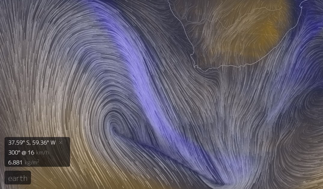
But a quick look at the beautiful graphics here shows a wonderful lilac arc of TPW – Total Precipitable Water – making its way steadily towards our little corner of the continent at about 75kph.

And while we’re desperate for the rain, we shouldn’t underestimate the effects of the incoming weather. Be prepared. Make sure your gutters and drains are clear of leaves and debris, stay inside tomorrow unless you really need to go out, make a plan to help your local homeless person/people.

UPDATE: The Haven Night Shelters have 15 shelters across Cape Town and the Western Cape. You can “buy a bed” at one of those shelters for a person who would otherwise be sleeping outside tonight by donating here.

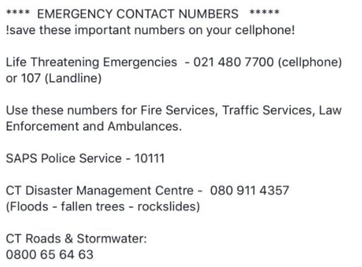
And be aware of who to call if you need assistance.

Beagle owners have been warned to look out for conditions like Tail Drift and Ear Flap. Smaller dogs should be sufficiently weighted if you plan to take them out for walkies rather than flyies. Cats are on their own, and that’s just how they like it.

Rainfall estimates are still between 50-100mm, according to the SA Weather Service, which has most of the province on high alert (ironically also for fires in the high winds ahead of the rain):

And Windguru agrees, adding winds peaking around 100kph at lunchtime on Wednesday, with swells of 11.7m by early on Wednesday evening. A reminder to stay safe if you’re going anywhere down the Atlantic seaboard tomorrow, especially around high tide (1430). Getting that photo is pointless if you are then washed away before you can upload it.

Batten down your respective hatches, Cape Town. Stay safe, stay warm.

Everybody’s talking about…

** Tuesday morning UPDATE: click here **

…the moerse storm which is due to make landfall in Cape Town late Tuesday or early Wednesday. Big storms are always big news, but because of our ongoing drought, this one is definitely more eagerly anticipated than most. It’s also arguably the biggest since this puppy hit us in August 2008.

Here’s the latest satellite image of our friend off the South West coast right now (0800 Monday): that dark area with a horn on it like some sort of malevolent unicorn.

So – some numbers:

Currently (Monday morning), Windguru is predicting 53.8 welcome millimetres of rain beginning at 11pm on Tuesday and continuing until Thursday evening.

Storm enthusiast Bryn de Kocks says:

The Boland area in particular seems likely to receive large amounts of rain, especially towards the mountain catchment regions where rainfall is likely to be heavier due to orographic effects. We should be able to expect rainfall measurements anywhere from 50mm to 100mm in the far SW Cape and Boland area.

And given the extreme nature of the deep low pressure area right now, this seems appropriate:

The rain is great, but I’m looking forward to the wind, which will be topping 100kph (Wednesday lunchtime) and which will be playing its part in generating swells of 11 metres (Wednesday afternoon/evening). Worryingly, this coincides with high tide on Wednesday (14:28), and with the moon almost full, there’s likely to be some flooding along the west coast.

Still, have camera, may well venture out.

Thursday looks to be the coldest day of the week with a chilly maximum of 12°C. So if you’re in Cape Town, wrap up warm and do your bit to try to help those less fortunate. And remember your emergency numbers:

  • Flooding, blocked drains and service disruptions – 0860 103 089 or SMS 31373
  • Electricity outages/disruptions – 0860 103 089 or SMS 31220.
  • Road Closures, delays on roadways and deviations – 0800 65 64 63
  • Weather Reports – Cape Town Weather Office (021 934 0749/0831), weatherline (083 123 0500), listen to alerts on the radio and television or visit www.weathersa.co.za
  • Emergencies – 107 from a landline or 021 480 7700 from a cellphone

And look out for updates on Twitter and Facebook.